Hotels in Puerto Rico
At the eastern end of Puerto Rico’s Ruta Panoramica, in downtown Yabucoa, the major road ends, and a narrow country lane winds straight ahead into the rising hills. Highway 901 is a slideshow, a scenic corniche road that has so far escaped the horrifying urbanization and development of Puerto Rico’s fabulous coastline.
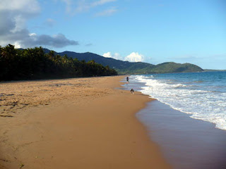
From Yabucoa it leads straight to the sea at Playa Lucia, a bedraggled but lovely palm-lined beach kept free of crowds by frankly dangerous currents.
Highway 901 climbs quickly past the beach, rising to the very cliff edge some 100 m (328 ft) high above the Caribebean, curling round the tail of the Cuchilla de Panduras Mountains as they drop into the sea. From here, you get a glorious view along the to of the cliffs: with a classic white lighthouse drawing your eye to the distance. Driving is hair - raising enough without going fast, because at several points the edge of the road is the edge of the drop. The view is the compensation for frazzled nerves.
The lighthouse is not open to the public, but you can stop outside it to admire the vistas either side of Punta Tuna, on which it stands. Below the rocky promontory, on both sides sandy coves are hemmed in with thick vegetation bursting with colourful flowers, their scent on the air. In crowded Puerto Rico, the breezy solitude is pure balm for the soul: it’s usually impossible to resist a scramble down to the beach itself before driving on. Above you, 901 swings back inland to join the roar of traffic at Maunabo, forming the norteastes boundary to the Punta Tuna wetland area of freshwater swamp and three kinds of mangrove. Like Highway 901, the reserve is tiny, beautiful, and a wonderful reminder that Puerto Rico’s coast isn’t all freeways and billboards.
HOW
By car
WHEN TO GO
November to June
TIME IT TAKES
One hour, although the road is only 15 km (9.3 mi). Everybody stops to admire the view.
HIGHLIGHTS
Leaving the freeway (full of traffic to and from the biggest naval base in the western hemisphere, 30 km north at Washington Roads).
The Punta Tuna west beach, protected from development so that light pollution does not distract hatching leatherback and hawksbill turtles, for which it is na important site.
The wetlands and mangrove forest, rare in Puerto Rico where backfill practices are common. Here the forest further protects turtles from human encroachment.
The romance of a sub-tropical cornice, the wind and the sun.
YOU SHOULD KNOW
1- The roadside trees chosen for their shade-providing properties are called “flamboyants”
2- Puerto Rican authorities are extending the freeway straight through the middle of Highway 901’s scenic wonders.
Hotels in Puerto Rico


