Monday, October 17, 2011
Sunday, October 16, 2011
Tuesday, October 11, 2011
Natural Beuty of Indonesia who stunning (part 2)
the fourth Komodo Island, NTT
Komodo National Park (TN. Komodo) is a region consisting of several islands with sea water. The islands are the habitat of the Komodo dragon (Varanus komodoensis) that the remaining ancient reptiles on earth. Unique natural conditions, there is a vast savanna lontarnya tree (Borassus flabellifer). And the most proud of right now, including Komodo Island in 7 Wonders of the World.
the fifth of Raja Ampat Island, Papua Barat
Raja Ampat Islands is an archipelago located in the western province of Papua New Guinea in the West, precisely at the head of birds of Papua. The islands are a diver's destination-divers interested in the beauty of the underwater scenery. So do not be surprised if one of the manufacturers of brand energy drinks use natural scenery of Papua, Papua's natural because it's very beautiful.
the sixth of Bunaken Sea Park, Sulawesi Utara
This marine park is famous for its beauty and its biodiversity. Even up to the international world! Bunaken marine park has a 20 point dive (dive spot) with varying depth of up to 1344 meters. Of the 20 diving points, 12 points among them diving around Bunaken Island. Twelve point dive is the most frequently visited by divers and lovers of the beauty of underwater scenery.
the seventh of Gunung Tujuh Lake, Jambi
Monday, October 10, 2011
Senggigi Beach
Senggigi Beach is the famous tourist attractions in Lombok. Located on the west coast of Lombok Island. Senggigi Beach is not at Kuta Beach in Bali, but once we were here will feel like staying in Kuta Beach, Bali. Coastal beaches are still beautiful, though still littered with garbage leaves because rarely cleaned. Very beautiful underwater scenery, and tourists can do such as snorkeling as the waves are not too big. Coral reefs are huge waves that towered ketengah cause rupture in the middle. There are also hotels with prices ranging from expensive economically valuable to the hotel. About half an hour by foot, the tourists can find the Batu Bolong on this beach. This is a temple built on a reef which is located on the waterfront. According to local legend of yore often held sacrifice a virgin to being fed to the sharks in this place. Another legend says the early days, many women who spread far from this place into the sea because of a broken heart. From this place also seen Mount Agung in Bali. Not far from Batu Bolong contained the tomb of a scholar. It is a sacred place for believers Wetu Telu. Senggigi Beach, located on the north ward, is the most popular beaches and famous for its beauty. The beach is located 12 kilometers northwest of Mataram, West Nusa Tenggara (NTB), Lombok, extending almost 10 km long with white sand that seems to tempt you to sit on it and for a moment forget all your life routine, traffic density cities, and inhale fresh air to enjoy the blue sea views and enjoy the sunset beautiful shades of green in
.
.
Island Umang
Island Umang
Island Umang located in the District of Wells, Pandeglang, Banten. This place is suitable to run away from the noise of the city and enjoy the beautiful moments honeymoon. On this island, there is a resort that is set up with an artistic touch of nature, beauty of the sea, surrounded by mountains increasingly add to the romantic atmosphere during their honeymoon.
Labels:
Island Umang
Takabonerate Island
Takabonerate Island
Takabonerate Selayar District, South Sulawesi, will be prepared as an international tourist destination with the agenda of the implementation of annual programs of international tourism. Takabonerate nautical tourism which is the third most beautiful marine park of the world who have millions of marine life is protected.
Labels:
Takabonerate Island
Sunday, October 9, 2011
Angel Falls
Hotels in Venezuela
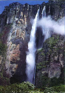
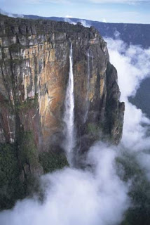
Sixteen times higher than Niagara, Angel Falls (Salto Angel) has an unibterrupted drop of 979 m (3212 ft), and are the highest in the world. Their exotic reputation is enhanced both by their remote location in southeastern Venezuela, and by the myths they have attracted. The Falls plunge over the rim of the largest of the region's sandstone mesas (sheer-sided mountains of dense jungle), called Auyantepui (home of god or evil) by the Pemon Indians who refused to venture onto it; and it was the direct inspiration for Conan Doyle's Lost World of mystery, darkness and dinossaurs.
You might take two, or six or even ten days to reach Angel Falls by boat. Starting southeast of Auyantepui, you can explore the orchid and bird-filled jungle paradise skirting the mesa, spending an adventurous week aboard a motorized curiara (dugout canoe) and sleeping in a hammock. you pause to swim through canyons (kavac) and frolic underneath waterfalls tumbling out of tangled flowers and foliage high in the riverbanks (toma de agua).
Eventually, you thread your passage through mild rapids on the Akanan River to the Carrao River, where you will meet other canoe parties heading for Angel Falls. Some will have flown direct to Canaima, intending to visit the Falls in two days: they will miss the pink and orange-coloured river beaches, the the cascades glowing gold in the sunset, the insights into their river and rainforest world you glean from talking to your Pemon guides and the villagers at campsites - the richness of other world experience that makes the breathtaking first sight of Angel Falls a culmation instead of a tick on a list. Every visitor follows the Churun River to Devil's Canyon, and Ratoncito Island. A short hike is rewarded by one of the world's genuinely awesome natural wonders - and just then, it's a pleasure to share it.
WHEN TO GO
June to November, when the rainy season has raised the river levels.
TIME IT TAKES
2 days (minimum from Canaia, the tourist base and air strip 50 km (31.5 mi northwest of Angel Falls); more usually 6-10 days to include exploration by river of the Canaima National Park.
HIGHLIGHTS
The Churun river rapids, going through Devil's Canyon.
The spectacular foliage-festooned cliffs at sunrise and set, reflected against the multi-coloured sky in the river's soft ripples.
The irresistible moment, when your dugout canoe is alone on a jungle river, that you can dream of being Indiana Jones.
Talking to Pemon Indians about their traditions.
Walking behind, and diving out of, the beautiful waterfalls of El Sapo, on the return journey to Canaima.
YOU SHOULD KNOW
Close to Angel Falls, even a few canoes can make the river feel like a traffic jam. But by restricting visitors to the Falls to defined routes and camp-sites, the rules also help preserve the flora and fauna of Canaima National Park - and permits to explore the hinterland are readily available to anyone interested.
Labels:
Venezuela
Carnic Peace Trail Via Alpina
Hotels in Lienz
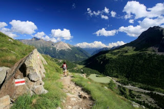
The Via Alpina is a network of trails traversing the Alps all the way from Trieste on the Adriatic to Monaco on the Mediterranean. It was established in 2005 to create a single cohesive route out of the countless existing trans-Alpine paths. The main artery, known as the Red Trail, is some 2400 km (1500 mi) long, broken down into 161 manageable stages as itt weaves its way back and forth across the borders of all the Alpine countries.
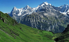
The summit trail along ridge of the Carnic Alps in eastern Austria has been integrated into the Red Trail. It was the front-line between the Austrians and Italians in World War I and, in the 1970s the supply paths used by the troops were linked up and given the symbolic name of the "Carnic Peace Trail" in remembrance of the devastating loss of life here - as many soldiers died from freezing weather conditions as were killed by the enemy. Easily as beautiful as anywhere else in the Alps, the Carnic Peace Trail is one of the less touristy sections of the Via Alpina.
You enter a timeless country of traditional villages and flower-strewn pastures, make hair-raising 750m (2500 ft) ascents and scramble across the valleys, wash in sparkling mountain water and wake each morning in a different mountain hut but to the same inevitable tinkling of cowbells and chorus of moos. A hike through the Austrian Alps really is the perfect way of getting away from it all - walking through some of the world's most beautiful scenery, spending the night in the shelter of spartan but adequate mountain huts, and living on th staple alpine diet of cured ham and un-pasteurised cheese, you cannot fail to be satisfied.
HOW
On foot
WHEN TO GO
June to September
TIME IT TAKES
A week (four months for the whole Via Alpina)
HIGHLIGHTS
Lienz - beautiful historic town.
Traces of trenches, battery positions and bivouacs rom World War I.
Medieval villages.
Outstanding natural scenery.
YOU SHOULD KNOW
The Carnic Peace Path is not technically difficult and requires no climbing equipment, merely sure-footedness and a good level of fitness. In July and August you will be hard to put to find yourself walking completely alone. Hordes of trekkers flock to the Alps at this time of year.
Labels:
Austria
Bangkok Sky Train
Hotels in Bangkok
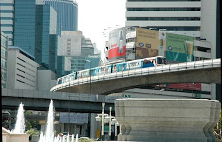
The Skytrain has changed the face of travel in Bangkok. It used to be a nightmare of a city where one could easily spend two hours travelling a distance of about 5 km (3 mi) because the weight of traffic was bringing the whole place to a grinding halt. All this changed on 5 December 1999, King Bhumibol's birthday, when the Skytrain opened. Approached by stairs and escalators, the ultra-modern elevated stations are airy, spacious, clean and safe. The platforms are marked to show where the carriage doors will open and, at rush hour, passengers queue up behind one another at these entry points, rather than filling the whole space. Inside there is plenty of sitting and standing room, and air-conditioning ensures a pleasant temperatures even when it is sweltering outside.
After a slow start, the Skytrain has really taken off, carrying passengers throughout the day, from 6.00 am to midnight. Apart from the miracle of being able to get around speedly, the train is fun to be on. Passengers get a fascinating, bird's eye view of the city. Not only is one amazed by the vast quantity of skyscrappers, a symphony of chrome, steel, glass and concrete but, in amongst the hyper-modernity are glimpses of ancient temples, their sweeping roofs glittering red and gold in the sunlight, housing stock that varies from villas with flower-decked gardens to slums whose grimy windows are cheek by jowl with the track, advertising hoardings, monuments, traffic circulating and Thais going about their business.
Several of the stations are linked to "skywalks", elevated walkways leading to nearby shopping malls and other amenities such as the National Stadium, the Chao Phraya River and the wonderful Chatuchak Weekend Market. The Skytrain, due to be extended, will eventually cross the river to Thonburi, and run out to Bangkok's new airport.
HOW
By train
WHEN TO GO
All year round, but best between October and April.
TIME IT TAKES
About one hour from end to end.
HIGHLIGHTS
The views over Bangkok from the elevated trains.
The welcome respite of the heat.
Nipping up to Mo Chit station on the Sukhumvit line to visit Chatuchak Weekend Market.
Saphan Taksin Station where you can join an express boat and take a trip on the river.
Siam station, where you can change lines or jump out and walk to one of the many shopping malls for some retails therapy.
YOU SHOULD KNOW
Bangkok now has a super modern metro that covers different areas to the Skytrain. There are currently three interchanges with Skytrain, and the metro does go to Hua Lamphong, the metro does go to Hua Lamphong, the main train station.
Hotels in Bangkok
Labels:
Thailand
Subscribe to:
Posts (Atom)


